GlacierNet
GlacierNet A Novel Deep Learning Approach for Debris-Covered Glacier Mapping
Introduction
The global temperature has been continuously increasing over the past decades. The effect of temperature increase can directly affect the health, dynamics, and processes of alpine glaciers. To understand these changes and extract regional trend, one of the basic steps is to map glaciers, either using the conventional method of field mapping or digital mapping using remote sensing techniques. However, glacier mapping is not straightforward using either of these techniques and it becomes much more difficult when it comes to mapping debris-covered glaciers (DCG). In this research, convolutional neural networks (CNN), which are deep learning, feed-forward neural networks, are utilized for automatic mapping of the DCG zone from snowline to the terminus.
Goals/Objectives
To automatically map the debris-covered glaciers (DCG) by using deep learning technology.
Methodology
The input data of GlacierNet includes Landsat 8 and topography data, and the expected output is from the Global Land Ice Measurements from Space (GLIMS) database. The GLIMS boundary is modified to remove the snow area and adjust for any changes that may have occurred due to terminus fluctuation. The network is constructed using encoding and decoding stages. The encoding stage mainly extracts features from input data. The extracted feature maps are used for the decoding stage to classify the objects (Figure 1). To improve the performance, post-processing is used to remove some misclassifications from the original network output (Figure 2).
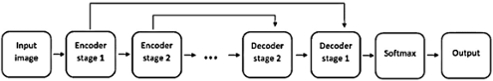 Figure 1. GlacierNet stage connection
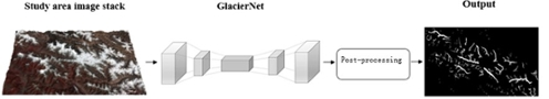 Figure 2. GlacierNet system structure
Results
The GlacierNet is applied to images collected from the Karakoram and Nepal Himalaya areas. It performs with exceedingly high accuracy in detecting the debris-covered glacier boundary, snowline, and terminus (Figures 3, 4, 5).
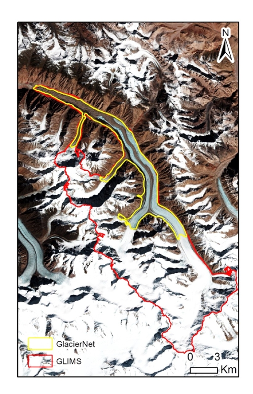 Figure 3. Debris-covered glacier mapping using GlacierNet
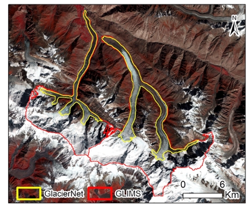 Figure 4. Debris-covered glacier mapping using GlacierNet
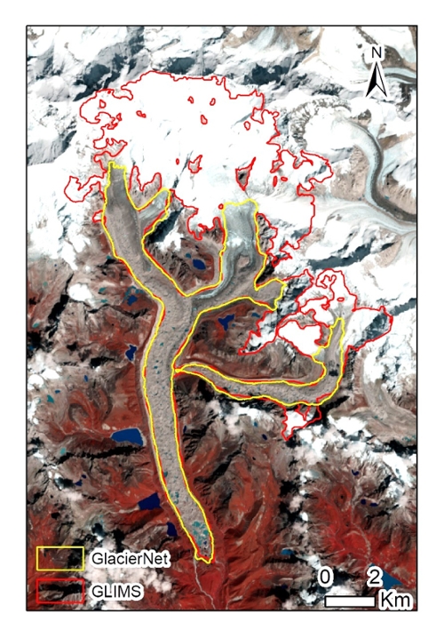 Figure 5. Debris-covered glacier mapping using GlacierNet